A slight change of subject from my recent posts on Pilgrims with Iñigo in the Holy Land, back to some more stuff on archaeology. I thought I’d share a couple of resources that I have found handy.
One of the great differences in the last twenty years when working on archaeology is the ready availability of satellite photography, and map servers of various kinds. Those in Malta will surely be familiar with the Planning Authority Map server [external link]. And, of course, there’s Google Maps and Google Earth. No more need for huge budgets to commission aerial photography, when you can have readily available satellite photography, and tools like Google Earth that allow you to roll back through various satellite images over time. Many sites in distant places have been identified thanks this ready availability.
Great resource for archaeologists, unless you’re dealing with the archaeology of Israel and the Palestinian Territories. The 1997 Kyl-Bingaman Amendment (KBA) to the U.S. National Defense Authorization Act made sure that the low resolution renders the satellite photography over Israel, the West Bank and the Gaza Strip, quite useless. There has been plenty of scientific and ethical debate on this issue, and things have changed significantly since July 2020, when the KBA was dropped. Despite the change, resources like Google Maps still offers low resolution imagery, so while the resources are available, you still need to know where to look.
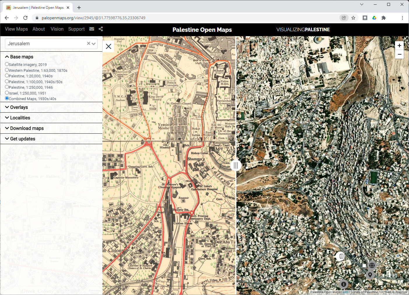
Palestine Open Maps
I stumbled upon a very useful map server — entitled Palestine Open Maps [external link] — that brings together, with a very friendly GUI, a series of very useful resources:
- Satellite imagery, 2019
- Western Palestine, 1:63,000, 1870s
- Palestine, 1:20,000, 1940s
- Palestine, 1:100,000, 1940s/50s
- Palestine, 1:250,000, 1946
- Israel, 1:250,000, 1951
- Combined Maps, 1930s/40s
I have found it highly convenient in being able to switch between the various resources, from the classic Survey of Western Palestine of the PEF, to the various Mandate period maps, and then decent enough satellite imagery. The resolution is still somewhat limited, but it’s far better than that on Google Maps or Google Earth. The GUI also allows you to download the source maps available for a specific area.
National Library of Israel
These mapping resources are no secret, and are readily available online. The National Library of Israel (NLI), for example, has plenty of maps dating to the period of the British Mandate in Palestine, including the 1:20,000 topocadastral maps [external link], which I have found particularly useful.
There’s plenty of other cartographic resources readily available on the NLI, which can come in handy, if you have the patience to trawl through the material.
Archaeological Survey of Israel
Another major resources that any archaeologist working in this region should be aware of is The Archaeological Survey of Israel [external link], published by the Israel Antiquities Authority. I find the GUI, available in both Hebrew and English, quite user friendly, with the option to scroll in on the satellite maps, and click on individual sites to see the entry in the archaeological survey.
As with all similar resources, the entries are far from exhaustive, but they do provide the key pointers to studies and publication, which I find very handy when dealing with the smaller sites.
